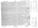
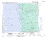
Maps showing Île Qikirtaaluk, Chisasibi; Jamésie, Quebec
Île Qikirtaaluk is a Island located in Chisasibi; Jamésie, Quebec.
- Latitude: 53° 41' 51'' North (decimal: 53.6975)
- Longitude: 79° 5' 40'' West (decimal: -79.0944444)
- Topography Feature Category: Island
- Geographical Feature: Île / Ile
- Canadian Province/Territory: Quebec
- Location: Chisasibi; Jamésie
- Atlas of Canada Locator Map: Île Qikirtaaluk
- GPS Coordinate Locator Map: Île Qikirtaaluk Lat/Long
Île Qikirtaaluk NTS Map Sheets