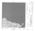
Maps showing Île Qikirtaq, Baie-d'Hudson; Kativik, Quebec
Île Qikirtaq is a Island located in Baie-d'Hudson; Kativik, Quebec.
- Latitude: 62° 17' 13'' North (decimal: 62.2869705)
- Longitude: 75° 33' 15'' West (decimal: -75.5542226)
- Topography Feature Category: Island
- Geographical Feature: Île / Ile
- Canadian Province/Territory: Quebec
- Location: Baie-d'Hudson; Kativik
- Atlas of Canada Locator Map: Île Qikirtaq
- GPS Coordinate Locator Map: Île Qikirtaq Lat/Long