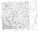
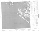
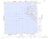
Maps showing Baie Tasiujaq, Baie-d'Hudson; Kativik, Quebec
Baie Tasiujaq is a Bay located in Baie-d'Hudson; Kativik, Quebec.
- Latitude: 58° 40' 13'' North (decimal: 58.6702778)
- Longitude: 78° 32' 42'' West (decimal: -78.545)
- Topography Feature Category: Bay
- Geographical Feature: Baie
- Canadian Province/Territory: Quebec
- Location: Baie-d'Hudson; Kativik
- GPS Coordinate Locator Map: Baie Tasiujaq Lat/Long
Baie Tasiujaq NTS Map Sheets