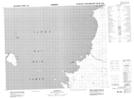
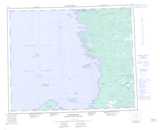
Maps showing Île Uchimaw, Baie-James; Jamésie, Quebec
Île Uchimaw is a Island located in Baie-James; Jamésie, Quebec.
- Latitude: 52° 14' 38'' North (decimal: 52.2438889)
- Longitude: 78° 34' 6'' West (decimal: -78.5683333)
- Topography Feature Category: Island
- Geographical Feature: Île / Ile
- Canadian Province/Territory: Quebec
- Location: Baie-James; Jamésie
- Atlas of Canada Locator Map: Île Uchimaw
- GPS Coordinate Locator Map: Île Uchimaw Lat/Long