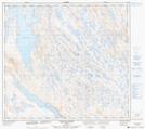
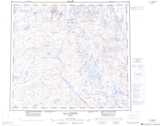
Maps showing Fort Mackenzie, Rivière-Koksoak; Kativik, Quebec
Fort Mackenzie is a Unincorporated area located in Rivière-Koksoak; Kativik, Quebec.
- Latitude: 56° 49' 47'' North (decimal: 56.8298602)
- Longitude: 68° 57' 8'' West (decimal: -68.9521211)
- Topography Feature Category: Unincorporated area
- Geographical Feature: Lieu-dit
- Canadian Province/Territory: Quebec
- Location: Rivière-Koksoak; Kativik
- Atlas of Canada Locator Map: Fort Mackenzie
- GPS Coordinate Locator Map: Fort Mackenzie Lat/Long
Fort Mackenzie NTS Map Sheets