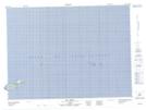
Maps showing L'Arbre-à-Spring, Les Îles-de-la-Madeleine; Les Îles-de-la-Madeleine, Quebec
L'Arbre-à-Spring is a Unincorporated area located in Les Îles-de-la-Madeleine; Les Îles-de-la-Madeleine, Quebec.
- Latitude: 47° 47' 12'' North (decimal: 47.7867306)
- Longitude: 61° 29' 22'' West (decimal: -61.4895477)
- Topography Feature Category: Unincorporated area
- Geographical Feature: Lieu-dit
- Canadian Province/Territory: Quebec
- Location: Les Îles-de-la-Madeleine; Les Îles-de-la-Madeleine
- Atlas of Canada Locator Map: L'Arbre-à-Spring
- GPS Coordinate Locator Map: L'Arbre-à-Spring Lat/Long
L'Arbre-à-Spring NTS Map Sheets