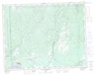
Maps showing Moisie-Salmon-Club, Sept-Îles; Sept-Rivières, Quebec
Moisie-Salmon-Club is a Unincorporated area located in Sept-Îles; Sept-Rivières, Quebec and has an elevation of 31 meters.
- Latitude: 50° 16' 51'' North (decimal: 50.2808825)
- Longitude: 66° 11' 37'' West (decimal: -66.1935547)
- Topography Feature Category: Unincorporated area
- Geographical Feature: Lieu-dit
- Canadian Province/Territory: Quebec
- Elevation: 31 meters
- Location: Sept-Îles; Sept-Rivières
- Atlas of Canada Locator Map: Moisie-Salmon-Club
- GPS Coordinate Locator Map: Moisie-Salmon-Club Lat/Long
Moisie-Salmon-Club NTS Map Sheets