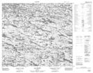
Maps showing Montagne Kukuminapin, Baie-d'Hudson; Kativik, Quebec
Montagne Kukuminapin is a Mountain located in Baie-d'Hudson; Kativik, Quebec.
- Latitude: 55° 51' 51'' North (decimal: 55.8641667)
- Longitude: 74° 41' 14'' West (decimal: -74.6872222)
- Topography Feature Category: Mountain
- Geographical Feature: Mont
- Canadian Province/Territory: Quebec
- Location: Baie-d'Hudson; Kativik
- Atlas of Canada Locator Map: Montagne Kukuminapin
- GPS Coordinate Locator Map: Montagne Kukuminapin Lat/Long
Montagne Kukuminapin NTS Map Sheets