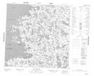
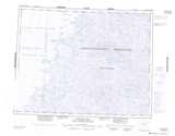
Maps showing Cap Aupaluk, Baie-d'Hudson; Kativik, Quebec
Cap Aupaluk is a Cape located in Baie-d'Hudson; Kativik, Quebec and has an elevation of 6 meters.
- Latitude: 59° 58' 28'' North (decimal: 59.9744444)
- Longitude: 77° 19' 13'' West (decimal: -77.3202778)
- Topography Feature Category: Cape
- Geographical Feature: Cap
- Canadian Province/Territory: Quebec
- Elevation: 6 meters
- Location: Baie-d'Hudson; Kativik
- Atlas of Canada Locator Map: Cap Aupaluk
- GPS Coordinate Locator Map: Cap Aupaluk Lat/Long
Cap Aupaluk NTS Map Sheets