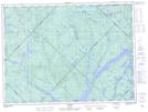
Maps showing Ruisseau Limit, La Tuque; Le Haut-Saint-Maurice, Quebec
Ruisseau Limit is a River located in La Tuque; Le Haut-Saint-Maurice, Quebec.
- Latitude: 47° 56' 27'' North (decimal: 47.9408829)
- Longitude: 73° 25' 4'' West (decimal: -73.4178910)
- Topography Feature Category: River
- Geographical Feature: Ruisseau
- Canadian Province/Territory: Quebec
- Location: La Tuque; Le Haut-Saint-Maurice
- GPS Coordinate Locator Map: Ruisseau Limit Lat/Long