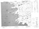
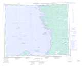
Maps showing Chiman Uchimaskwaw, Baie-James; Jamésie, Quebec
Chiman Uchimaskwaw is a Unincorporated area located in Baie-James; Jamésie, Quebec.
- Latitude: 52° 31' 24'' North (decimal: 52.5233333)
- Longitude: 78° 38' 10'' West (decimal: -78.6361111)
- Topography Feature Category: Unincorporated area
- Geographical Feature: Lieu-dit
- Canadian Province/Territory: Quebec
- Location: Baie-James; Jamésie
- Atlas of Canada Locator Map: Chiman Uchimaskwaw
- GPS Coordinate Locator Map: Chiman Uchimaskwaw Lat/Long
Chiman Uchimaskwaw NTS Map Sheets