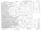
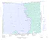
Maps showing Ruisseau Wastiwawmaw, Wemindji; Jamésie, Quebec
Ruisseau Wastiwawmaw is a River located in Wemindji; Jamésie, Quebec.
- Latitude: 52° 52' 24'' North (decimal: 52.8733333)
- Longitude: 78° 48' 30'' West (decimal: -78.8083333)
- Topography Feature Category: River
- Geographical Feature: Ruisseau
- Canadian Province/Territory: Quebec
- Location: Wemindji; Jamésie
- Atlas of Canada Locator Map: Ruisseau Wastiwawmaw
- GPS Coordinate Locator Map: Ruisseau Wastiwawmaw Lat/Long