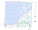
Maps showing Baie Aapamach, Baie-d'Hudson; Kativik, Quebec
Baie Aapamach is a Bay located in Baie-d'Hudson; Kativik, Quebec and has an elevation of 18 meters.
- Latitude: 55° 17' 00'' North (decimal: 55.2832055)
- Longitude: 77° 37' 11'' West (decimal: -77.6197459)
- Topography Feature Category: Bay
- Geographical Feature: Baie
- Canadian Province/Territory: Quebec
- Elevation: 18 meters
- Location: Baie-d'Hudson; Kativik
- Atlas of Canada Locator Map: Baie Aapamach
- GPS Coordinate Locator Map: Baie Aapamach Lat/Long
Baie Aapamach NTS Map Sheets