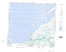
Maps showing Lac Kamiskutayakamaw, Whapmagoostui; Jamésie, Quebec
Lac Kamiskutayakamaw is a Lake located in Whapmagoostui; Jamésie, Quebec.
- Latitude: 55° 17' 1'' North (decimal: 55.2834835)
- Longitude: 77° 39' 24'' West (decimal: -77.6566921)
- Topography Feature Category: Lake
- Geographical Feature: Lac
- Canadian Province/Territory: Quebec
- Location: Whapmagoostui; Jamésie
- Atlas of Canada Locator Map: Lac Kamiskutayakamaw
- GPS Coordinate Locator Map: Lac Kamiskutayakamaw Lat/Long
Lac Kamiskutayakamaw NTS Map Sheets