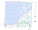
Maps showing Île Qijuttuukallak, Baie-d'Hudson; Kativik, Quebec
Île Qijuttuukallak is a Island located in Baie-d'Hudson; Kativik, Quebec and has an elevation of 17 meters.
- Latitude: 55° 16' 39'' North (decimal: 55.2773722)
- Longitude: 77° 39' 21'' West (decimal: -77.6558589)
- Topography Feature Category: Island
- Geographical Feature: Île / Ile
- Canadian Province/Territory: Quebec
- Elevation: 17 meters
- Location: Baie-d'Hudson; Kativik
- Atlas of Canada Locator Map: Île Qijuttuukallak
- GPS Coordinate Locator Map: Île Qijuttuukallak Lat/Long
Île Qijuttuukallak NTS Map Sheets