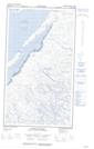
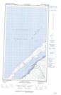
Maps showing Rivière Kaychisakach Kaysinakuch, Baie-d'Hudson; Kativik, Quebec
Rivière Kaychisakach Kaysinakuch is a River located in Baie-d'Hudson; Kativik, Quebec.
- Latitude: 55° 44' 53'' North (decimal: 55.7480556)
- Longitude: 77° 4' 1'' West (decimal: -77.0669444)
- Topography Feature Category: River
- Geographical Feature: Rivière
- Canadian Province/Territory: Quebec
- Location: Baie-d'Hudson; Kativik
- Atlas of Canada Locator Map: Rivière Kaychisakach Kaysinakuch
- GPS Coordinate Locator Map: Rivière Kaychisakach Kaysinakuch Lat/Long
Rivière Kaychisakach Kaysinakuch NTS Map Sheets