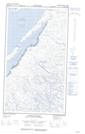
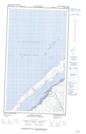
Maps showing Pointes Upirngivik, Baie-d'Hudson; Kativik, Quebec
Pointes Upirngivik is a Cape located in Baie-d'Hudson; Kativik, Quebec.
- Latitude: 55° 43' 35'' North (decimal: 55.7263889)
- Longitude: 77° 6' 27'' West (decimal: -77.1075)
- Topography Feature Category: Cape
- Geographical Feature: Pointes
- Canadian Province/Territory: Quebec
- Location: Baie-d'Hudson; Kativik
- Atlas of Canada Locator Map: Pointes Upirngivik
- GPS Coordinate Locator Map: Pointes Upirngivik Lat/Long
Pointes Upirngivik NTS Map Sheets