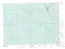
Maps showing Letang, Témiscaming; Témiscamingue, Quebec
Letang is a Village located in Témiscaming; Témiscamingue, Quebec.
- Latitude: 46° 43' 16'' North (decimal: 46.7211111)
- Longitude: 79° 5' 51'' West (decimal: -79.0975)
- Topography Feature Category: Village
- Geographical Feature: Municipalité
- Canadian Province/Territory: Quebec
- Location: Témiscaming; Témiscamingue
- GPS Coordinate Locator Map: Letang Lat/Long
Letang NTS Map Sheets
031J09 Saint-Guillaume-Nord Topographic Map at 1:50,000 scale
031L11 Temiscaming Topographic Map at 1:50,000 scale
031L14 Ottertail Creek Topographic Map at 1:50,000 scale
031L15 Lac Grindstone Topographic Map at 1:50,000 scale
031J Mont-Laurier Topographic Map at 1:250,000 scale
031L North Bay Topographic Map at 1:250,000 scale
031L11 Temiscaming Topographic Map at 1:50,000 scale
031L14 Ottertail Creek Topographic Map at 1:50,000 scale
031L15 Lac Grindstone Topographic Map at 1:50,000 scale
031J Mont-Laurier Topographic Map at 1:250,000 scale
031L North Bay Topographic Map at 1:250,000 scale