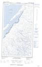
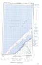
Maps showing Kingittualuup Kuunga, Baie-d'Hudson; Kativik, Quebec
Kingittualuup Kuunga is a River located in Baie-d'Hudson; Kativik, Quebec.
- Latitude: 55° 35' 16'' North (decimal: 55.5877778)
- Longitude: 77° 13' 47'' West (decimal: -77.2297221)
- Topography Feature Category: River
- Geographical Feature: Rivière
- Canadian Province/Territory: Quebec
- Location: Baie-d'Hudson; Kativik
- GPS Coordinate Locator Map: Kingittualuup Kuunga Lat/Long
Kingittualuup Kuunga NTS Map Sheets