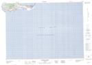
Maps showing Le Moulin, Les Îles-de-la-Madeleine; Les Îles-de-la-Madeleine, Quebec
Le Moulin is a Unincorporated area located in Les Îles-de-la-Madeleine; Les Îles-de-la-Madeleine, Quebec and has an elevation of 25 meters.
- Latitude: 47° 13' 10'' North (decimal: 47.2195139)
- Longitude: 61° 57' 7'' West (decimal: -61.9520626)
- Topography Feature Category: Unincorporated area
- Geographical Feature: Hameau
- Canadian Province/Territory: Quebec
- Elevation: 25 meters
- Location: Les Îles-de-la-Madeleine; Les Îles-de-la-Madeleine
- Atlas of Canada Locator Map: Le Moulin
- GPS Coordinate Locator Map: Le Moulin Lat/Long
Le Moulin NTS Map Sheets