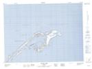
Maps showing Lac aux Canards, Les Îles-de-la-Madeleine; Les Îles-de-la-Madeleine, Quebec
Lac aux Canards is a Lake located in Les Îles-de-la-Madeleine; Les Îles-de-la-Madeleine, Quebec and has an elevation of 4 meters.
- Latitude: 47° 31' 33'' North (decimal: 47.5259011)
- Longitude: 61° 42' 51'' West (decimal: -61.7142770)
- Topography Feature Category: Lake
- Geographical Feature: Étang
- Canadian Province/Territory: Quebec
- Elevation: 4 meters
- Location: Les Îles-de-la-Madeleine; Les Îles-de-la-Madeleine
- GPS Coordinate Locator Map: Lac aux Canards Lat/Long
Lac aux Canards NTS Map Sheets