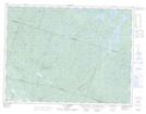
Maps showing Rivière Anderson, Saint-Fulgence; Le Fjord-du-Saguenay, Quebec
Rivière Anderson is a River located in Saint-Fulgence; Le Fjord-du-Saguenay, Quebec.
- Latitude: 48° 27' 16'' North (decimal: 48.4544849)
- Longitude: 70° 55' 8'' West (decimal: -70.9189708)
- Topography Feature Category: River
- Geographical Feature: Rivière
- Canadian Province/Territory: Quebec
- Location: Saint-Fulgence; Le Fjord-du-Saguenay
- GPS Coordinate Locator Map: Rivière Anderson Lat/Long
Rivière Anderson NTS Map Sheets