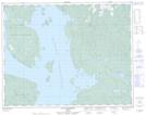
Maps showing Lac Brûlé, La Tuque; Le Haut-Saint-Maurice, Quebec
Lac Brûlé is a Lake located in La Tuque; Le Haut-Saint-Maurice, Quebec.
- Latitude: 47° 28' 00'' North (decimal: 47.4666666)
- Longitude: 72° 19' 37'' West (decimal: -72.3269444)
- Topography Feature Category: Lake
- Geographical Feature: Lac
- Canadian Province/Territory: Quebec
- Location: La Tuque; Le Haut-Saint-Maurice
- Atlas of Canada Locator Map: Lac Brûlé
- GPS Coordinate Locator Map: Lac Brûlé Lat/Long
Lac Brûlé NTS Map Sheets