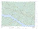
Maps showing Les Étangs, Rivière-Éternité; Le Fjord-du-Saguenay, Quebec
Les Étangs is a Lake located in Rivière-Éternité; Le Fjord-du-Saguenay, Quebec.
- Latitude: 48° 18' 12'' North (decimal: 48.3033636)
- Longitude: 70° 29' 18'' West (decimal: -70.4884038)
- Topography Feature Category: Lake
- Geographical Feature: Lacs
- Canadian Province/Territory: Quebec
- Location: Rivière-Éternité; Le Fjord-du-Saguenay
- Atlas of Canada Locator Map: Les Étangs
- GPS Coordinate Locator Map: Les Étangs Lat/Long
Les Étangs NTS Map Sheets