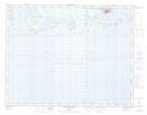
Maps showing Le Grand Reef, Havre-Saint-Pierre; Minganie, Quebec
Le Grand Reef is a Shoal located in Havre-Saint-Pierre; Minganie, Quebec.
- Latitude: 50° 11' 32'' North (decimal: 50.1922221)
- Longitude: 63° 44' 47'' West (decimal: -63.7463889)
- Topography Feature Category: Shoal
- Geographical Feature: Récifs
- Canadian Province/Territory: Quebec
- Location: Havre-Saint-Pierre; Minganie
- Atlas of Canada Locator Map: Le Grand Reef
- GPS Coordinate Locator Map: Le Grand Reef Lat/Long
Le Grand Reef NTS Map Sheets