Maps showing La Grosse Roche, Saguenay; Saguenay, Quebec
La Grosse Roche is a Island located in Saguenay; Saguenay, Quebec and has an elevation of 164 meters.
- Latitude: 48° 20' 44'' North (decimal: 48.3455556)
- Longitude: 71° 16' 30'' West (decimal: -71.275)
- Topography Feature Category: Island
- Geographical Feature: Rocher
- Canadian Province/Territory: Quebec
- Elevation: 164 meters
- Location: Saguenay; Saguenay
- Atlas of Canada Locator Map: La Grosse Roche
- GPS Coordinate Locator Map: La Grosse Roche Lat/Long
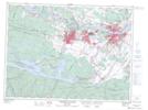
La Grosse Roche NTS Map Sheets