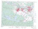
Maps showing Pont de Sainte-Anne, Saguenay; Saguenay, Quebec
Pont de Sainte-Anne is a Road feature located in Saguenay; Saguenay, Quebec and has an elevation of 47 meters.
- Latitude: 48° 25' 58'' North (decimal: 48.4327778)
- Longitude: 71° 4' 4'' West (decimal: -71.0677778)
- Topography Feature Category: Road feature
- Geographical Feature: Pont
- Canadian Province/Territory: Quebec
- Elevation: 47 meters
- Location: Saguenay; Saguenay
- Atlas of Canada Locator Map: Pont de Sainte-Anne
- GPS Coordinate Locator Map: Pont de Sainte-Anne Lat/Long
Pont de Sainte-Anne NTS Map Sheets