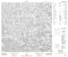
Maps showing Lac du Boulder, Rivière-Koksoak; Kativik, Quebec
Lac du Boulder is a Lake located in Rivière-Koksoak; Kativik, Quebec.
- Latitude: 59° 45' 36'' North (decimal: 59.7599599)
- Longitude: 74° 34' 26'' West (decimal: -74.5739814)
- Topography Feature Category: Lake
- Geographical Feature: Lac
- Canadian Province/Territory: Quebec
- Location: Rivière-Koksoak; Kativik
- Atlas of Canada Locator Map: Lac du Boulder
- GPS Coordinate Locator Map: Lac du Boulder Lat/Long