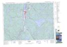
Maps showing Étang au Cornichon, La Tuque; Le Haut-Saint-Maurice, Quebec
Étang au Cornichon is a Lake located in La Tuque; Le Haut-Saint-Maurice, Quebec.
- Latitude: 47° 20' 38'' North (decimal: 47.3439216)
- Longitude: 72° 35' 47'' West (decimal: -72.5964937)
- Topography Feature Category: Lake
- Geographical Feature: Étang
- Canadian Province/Territory: Quebec
- Location: La Tuque; Le Haut-Saint-Maurice
- GPS Coordinate Locator Map: Étang au Cornichon Lat/Long