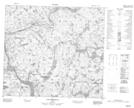
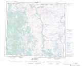
Maps showing Anukuepin Pikatan, Rivière-Koksoak; Kativik, Quebec
Anukuepin Pikatan is a Road feature located in Rivière-Koksoak; Kativik, Quebec.
- Latitude: 56° 48' 25'' North (decimal: 56.8069444)
- Longitude: 64° 55' 51'' West (decimal: -64.9308333)
- Topography Feature Category: Road feature
- Geographical Feature: Portage
- Canadian Province/Territory: Quebec
- Location: Rivière-Koksoak; Kativik
- GPS Coordinate Locator Map: Anukuepin Pikatan Lat/Long
Anukuepin Pikatan NTS Map Sheets