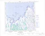
Maps showing Tsheteskushueu, Rivière-Koksoak; Kativik, Quebec
Tsheteskushueu is a Lake located in Rivière-Koksoak; Kativik, Quebec.
- Latitude: 58° 17' 53'' North (decimal: 58.2980556)
- Longitude: 66° 12' 48'' West (decimal: -66.2133333)
- Topography Feature Category: Lake
- Geographical Feature: Lac
- Canadian Province/Territory: Quebec
- Location: Rivière-Koksoak; Kativik
- GPS Coordinate Locator Map: Tsheteskushueu Lat/Long
Tsheteskushueu NTS Map Sheets