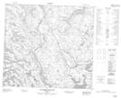
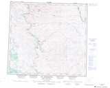
Maps showing Mitshu Kaiskuashuant, Rivière-Koksoak; Kativik, Quebec
Mitshu Kaiskuashuant is a Lake located in Rivière-Koksoak; Kativik, Quebec.
- Latitude: 57° 28' 20'' North (decimal: 57.4720843)
- Longitude: 65° 7' 20'' West (decimal: -65.1222147)
- Topography Feature Category: Lake
- Geographical Feature: Lac
- Canadian Province/Territory: Quebec
- Location: Rivière-Koksoak; Kativik
- GPS Coordinate Locator Map: Mitshu Kaiskuashuant Lat/Long
Mitshu Kaiskuashuant NTS Map Sheets