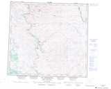
Maps showing Chute Kapaustikuts, Rivière-Koksoak; Kativik, Quebec
Chute Kapaustikuts is a Falls located in Rivière-Koksoak; Kativik, Quebec.
- Latitude: 57° 2' 53'' North (decimal: 57.0481802)
- Longitude: 65° 18' 13'' West (decimal: -65.3036089)
- Topography Feature Category: Falls
- Geographical Feature: Chute
- Canadian Province/Territory: Quebec
- Location: Rivière-Koksoak; Kativik
- Atlas of Canada Locator Map: Chute Kapaustikuts
- GPS Coordinate Locator Map: Chute Kapaustikuts Lat/Long
Chute Kapaustikuts NTS Map Sheets