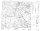
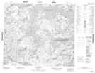
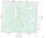
Maps showing Lac Kapishuiakamit, Rivière-Koksoak; Kativik, Quebec
Lac Kapishuiakamit is a Lake located in Rivière-Koksoak; Kativik, Quebec.
- Latitude: 55° 53' 39'' North (decimal: 55.8942792)
- Longitude: 64° 32' 54'' West (decimal: -64.5483499)
- Topography Feature Category: Lake
- Geographical Feature: Lac
- Canadian Province/Territory: Quebec
- Location: Rivière-Koksoak; Kativik
- Atlas of Canada Locator Map: Lac Kapishuiakamit
- GPS Coordinate Locator Map: Lac Kapishuiakamit Lat/Long
Lac Kapishuiakamit NTS Map Sheets