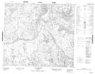
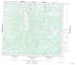
Maps showing Rocher Mashku, Rivière-Koksoak; Kativik, Quebec
Rocher Mashku is a Island located in Rivière-Koksoak; Kativik, Quebec.
- Latitude: 55° 58' 17'' North (decimal: 55.9713889)
- Longitude: 64° 43' 47'' West (decimal: -64.7297222)
- Topography Feature Category: Island
- Geographical Feature: Rocher
- Canadian Province/Territory: Quebec
- Location: Rivière-Koksoak; Kativik
- Atlas of Canada Locator Map: Rocher Mashku
- GPS Coordinate Locator Map: Rocher Mashku Lat/Long