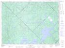
Maps showing Île Toro, Baie-Obaoca; Matawinie, Quebec
Île Toro is a Island located in Baie-Obaoca; Matawinie, Quebec.
- Latitude: 47° 31' 36'' North (decimal: 47.5266667)
- Longitude: 74° 17' 36'' West (decimal: -74.2933333)
- Topography Feature Category: Island
- Geographical Feature: Île / Ile
- Canadian Province/Territory: Quebec
- Location: Baie-Obaoca; Matawinie
- Atlas of Canada Locator Map: Île Toro
- GPS Coordinate Locator Map: Île Toro Lat/Long
Île Toro NTS Map Sheets