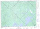
Maps showing Étang Pikotowok, Baie-Obaoca; Matawinie, Quebec
Étang Pikotowok is a Lake located in Baie-Obaoca; Matawinie, Quebec.
- Latitude: 47° 32' 33'' North (decimal: 47.5425)
- Longitude: 74° 18' 23'' West (decimal: -74.3063889)
- Topography Feature Category: Lake
- Geographical Feature: Étang
- Canadian Province/Territory: Quebec
- Location: Baie-Obaoca; Matawinie
- Atlas of Canada Locator Map: Étang Pikotowok
- GPS Coordinate Locator Map: Étang Pikotowok Lat/Long
Étang Pikotowok NTS Map Sheets