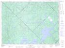
Maps showing Nemickaci Saki, Lac-Akonapwehikan; Antoine-Labelle, Quebec
Nemickaci Saki is a Unincorporated area located in Lac-Akonapwehikan; Antoine-Labelle, Quebec.
- Latitude: 47° 30' 24'' North (decimal: 47.5067293)
- Longitude: 74° 25' 39'' West (decimal: -74.4273666)
- Topography Feature Category: Unincorporated area
- Geographical Feature: Lieu-dit
- Canadian Province/Territory: Quebec
- Location: Lac-Akonapwehikan; Antoine-Labelle
- Atlas of Canada Locator Map: Nemickaci Saki
- GPS Coordinate Locator Map: Nemickaci Saki Lat/Long
Nemickaci Saki NTS Map Sheets