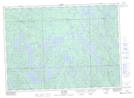
Maps showing La Longue Pointe, Rivière-Kipawa; Témiscamingue, Quebec
La Longue Pointe is a Cape located in Rivière-Kipawa; Témiscamingue, Quebec and has an elevation of 321 meters.
- Latitude: 46° 37' 46'' North (decimal: 46.6294444)
- Longitude: 78° 24' 36'' West (decimal: -78.4099999)
- Topography Feature Category: Cape
- Geographical Feature: Pointe
- Canadian Province/Territory: Quebec
- Elevation: 321 meters
- Location: Rivière-Kipawa; Témiscamingue
- Atlas of Canada Locator Map: La Longue Pointe
- GPS Coordinate Locator Map: La Longue Pointe Lat/Long