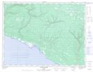
Maps showing Étang du Canard, L'Île-d'Anticosti; Minganie, Quebec
Étang du Canard is a Low vegetation located in L'Île-d'Anticosti; Minganie, Quebec.
- Latitude: 49° 19' 55'' North (decimal: 49.3320104)
- Longitude: 63° 20' 6'' West (decimal: -63.3351336)
- Topography Feature Category: Low vegetation
- Geographical Feature: Marécage
- Canadian Province/Territory: Quebec
- Location: L'Île-d'Anticosti; Minganie
- Atlas of Canada Locator Map: Étang du Canard
- GPS Coordinate Locator Map: Étang du Canard Lat/Long
Étang du Canard NTS Map Sheets