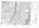
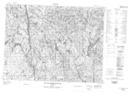
Maps showing Lac des Îles, Chute-des-Passes; Maria-Chapdelaine, Quebec
Lac des Îles is a Lake located in Chute-des-Passes; Maria-Chapdelaine, Quebec.
- Latitude: 49° 1' 5'' North (decimal: 49.0180556)
- Longitude: 71° 29' 24'' West (decimal: -71.49)
- Topography Feature Category: Lake
- Geographical Feature: Lac
- Canadian Province/Territory: Quebec
- Location: Chute-des-Passes; Maria-Chapdelaine
- GPS Coordinate Locator Map: Lac des Îles Lat/Long
Lac des Îles NTS Map Sheets