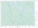
Maps showing Pointe Mitciteckote, Manawan; Matawinie, Quebec
Pointe Mitciteckote is a Cape located in Manawan; Matawinie, Quebec.
- Latitude: 47° 13' 9'' North (decimal: 47.2192239)
- Longitude: 74° 22' 34'' West (decimal: -74.3759819)
- Topography Feature Category: Cape
- Geographical Feature: Pointe
- Canadian Province/Territory: Quebec
- Location: Manawan; Matawinie
- Atlas of Canada Locator Map: Pointe Mitciteckote
- GPS Coordinate Locator Map: Pointe Mitciteckote Lat/Long
Pointe Mitciteckote NTS Map Sheets