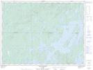
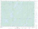
Maps showing Katwapiskitewakamak, Senneterre; Vallée-de-l'Or, Quebec
Katwapiskitewakamak is a Lake located in Senneterre; Vallée-de-l'Or, Quebec.
- Latitude: 48° 35' 12'' North (decimal: 48.5867364)
- Longitude: 75° 31' 17'' West (decimal: -75.5212741)
- Topography Feature Category: Lake
- Geographical Feature: Lac
- Canadian Province/Territory: Quebec
- Location: Senneterre; Vallée-de-l'Or
- GPS Coordinate Locator Map: Katwapiskitewakamak Lat/Long
Katwapiskitewakamak NTS Map Sheets