Maps showing Rivière Kaapicikatew, La Tuque; Le Haut-Saint-Maurice, Quebec
Rivière Kaapicikatew is a River located in La Tuque; Le Haut-Saint-Maurice, Quebec.
- Latitude: 48° 49' 8'' North (decimal: 48.8189573)
- Longitude: 75° 20' 58'' West (decimal: -75.3493247)
- Topography Feature Category: River
- Geographical Feature: Rivière
- Canadian Province/Territory: Quebec
- Location: La Tuque; Le Haut-Saint-Maurice
- Atlas of Canada Locator Map: Rivière Kaapicikatew
- GPS Coordinate Locator Map: Rivière Kaapicikatew Lat/Long
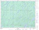
Rivière Kaapicikatew NTS Map Sheets