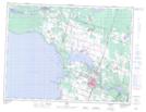
Maps showing Plage Saint-Gédéon, Saint-Gédéon; Lac-Saint-Jean-Est, Quebec
Plage Saint-Gédéon is a Beach located in Saint-Gédéon; Lac-Saint-Jean-Est, Quebec.
- Latitude: 48° 30' 5'' North (decimal: 48.5013889)
- Longitude: 71° 47' 4'' West (decimal: -71.7844444)
- Topography Feature Category: Beach
- Geographical Feature: Plage
- Canadian Province/Territory: Quebec
- Location: Saint-Gédéon; Lac-Saint-Jean-Est
- Atlas of Canada Locator Map: Plage Saint-Gédéon
- GPS Coordinate Locator Map: Plage Saint-Gédéon Lat/Long