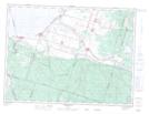
Maps showing Cours d'eau du Rang Quatre, Métabetchouan¿Lac-à-la-Croix; Lac-Saint-Jean-Est, Quebec
Cours d'eau du Rang Quatre is a River located in Métabetchouan¿Lac-à-la-Croix; Lac-Saint-Jean-Est, Quebec.
- Latitude: 48° 22' 59'' North (decimal: 48.3830556)
- Longitude: 71° 49' 35'' West (decimal: -71.8263889)
- Topography Feature Category: River
- Geographical Feature: Cours d'eau agricole
- Canadian Province/Territory: Quebec
- Location: Métabetchouan¿Lac-à-la-Croix; Lac-Saint-Jean-Est
- Atlas of Canada Locator Map: Cours d'eau du Rang Quatre
- GPS Coordinate Locator Map: Cours d'eau du Rang Quatre Lat/Long
Cours d'eau du Rang Quatre NTS Map Sheets