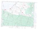
Maps showing Pointe aux Trembles, Chambord; Le Domaine-du-Roy, Quebec
Pointe aux Trembles is a Cape located in Chambord; Le Domaine-du-Roy, Quebec.
- Latitude: 48° 25' 27'' North (decimal: 48.4241667)
- Longitude: 71° 58' 14'' West (decimal: -71.9705555)
- Topography Feature Category: Cape
- Geographical Feature: Pointe
- Canadian Province/Territory: Quebec
- Location: Chambord; Le Domaine-du-Roy
- Atlas of Canada Locator Map: Pointe aux Trembles
- GPS Coordinate Locator Map: Pointe aux Trembles Lat/Long
Pointe aux Trembles NTS Map Sheets