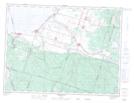
Maps showing Rivière L'Abbé, Chambord; Le Domaine-du-Roy, Quebec
Rivière L'Abbé is a River located in Chambord; Le Domaine-du-Roy, Quebec.
- Latitude: 48° 22' 32'' North (decimal: 48.3756019)
- Longitude: 71° 59' 15'' West (decimal: -71.9876183)
- Topography Feature Category: River
- Geographical Feature: Ruisseau
- Canadian Province/Territory: Quebec
- Location: Chambord; Le Domaine-du-Roy
- Atlas of Canada Locator Map: Rivière L'Abbé
- GPS Coordinate Locator Map: Rivière L'Abbé Lat/Long
Rivière L'Abbé NTS Map Sheets