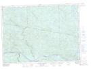
Maps showing Lac du Pin Rouge, Rivière-Kipawa; Témiscamingue, Quebec
Lac du Pin Rouge is a Lake located in Rivière-Kipawa; Témiscamingue, Quebec and has an elevation of 348 meters.
- Latitude: 46° 19' 40'' North (decimal: 46.3278370)
- Longitude: 78° 8' 14'' West (decimal: -78.1372643)
- Topography Feature Category: Lake
- Geographical Feature: Lac
- Canadian Province/Territory: Quebec
- Elevation: 348 meters
- Location: Rivière-Kipawa; Témiscamingue
- Atlas of Canada Locator Map: Lac du Pin Rouge
- GPS Coordinate Locator Map: Lac du Pin Rouge Lat/Long
Lac du Pin Rouge NTS Map Sheets