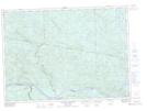
Maps showing Lac de la Cartouche, Rivière-Kipawa; Témiscamingue, Quebec
Lac de la Cartouche is a Lake located in Rivière-Kipawa; Témiscamingue, Quebec and has an elevation of 392 meters.
- Latitude: 46° 27' 10'' North (decimal: 46.4528364)
- Longitude: 78° 4' 59'' West (decimal: -78.0830948)
- Topography Feature Category: Lake
- Geographical Feature: Lac
- Canadian Province/Territory: Quebec
- Elevation: 392 meters
- Location: Rivière-Kipawa; Témiscamingue
- Atlas of Canada Locator Map: Lac de la Cartouche
- GPS Coordinate Locator Map: Lac de la Cartouche Lat/Long
Lac de la Cartouche NTS Map Sheets